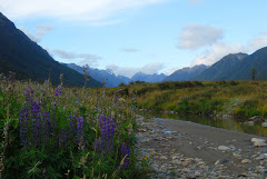
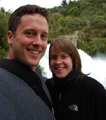
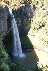
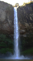
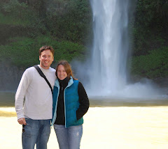
Easter Friday and Easter Monday are holidays here, and while Cory was on call on Friday, he did have Monday off. So we thought we’d better squeeze in a trip down to the Tongariro Mountain Range. We’d been hoping to do the Tongariro Crossing, which winds between Mt. Tongariro and Mt. Ngauruhoe, two dormant volcanoes.
Considered one of the best “day walks” in NZ, it takes from between 5 ½ to 8 hours. After a short climb, you are able to walk along the pass between the two volcanoes before descending on the other side. All literature about the walk warns readers that sturdy boots, adequate water, and appropriate clothing are necessary, as you are exposed with no cover for most of the walk. In the summer, the sun beats down, making it very hot; in the winter, the area is covered in snow. But the fall and the spring, especially on a gorgeous day like we had, offer beautiful views of pretty stunning scenery.
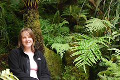
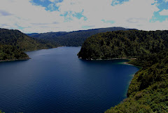
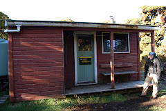
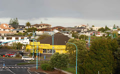
The Tongariro National Park was the first national park in New Zealand (and the fourth in the world); it was also the first national park to be gifted to a country from its indigenous people. The national park was formed before now-common ideas about conservation were established, which helps explain the oddity of having a town within the park. This town is suitably named National Park, and it is where Cory and I stayed. National Park is actually considered a village, and mostly consists of small lodges, hotels, cafes, and ski apparel stores. We had booked a package deal with one of the lodges; the package provided us with two nights’ accommodation, two breakfasts, food for the walk, dinner, transport to and from the track, and (murmured oh’s and ah’s…) a t-shirt.
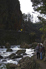
Because of its length (long enough to offer a challenge, but short enough to be accessible to many), the Tongariro Crossing is very popular. This was definitely evidenced as we pulled into the car park on Sunday morning. The place was packed. Easter weekend and the start of school holidays (two weeks off between term one and term two) probably were popular choices for many, but I hadn’t prepared myself for just how busy it might be!
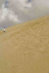
But we settled in to our walk. The first hour was fairly flat and easy-going. The second hour made up for any feelings of boredom by offering a steady climb up what is known as the Devil’s Staircase. The name does not suggest that the climb was easy, and I will not do so either. It was, however, well-maintained, with, quite literally, stairs for the steepest sections. It wasn’t really a pleasant walk, but it probably didn’t require the drama offered by a woman behind us as we climbed. She breathed heavily and really very loudly, sometimes letting out a short scream. At one point she ran past us, only to throw herself on the ground and sob. I couldn’t decide if it was funny or really bizarre; I’ve since decided it was both.
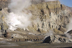
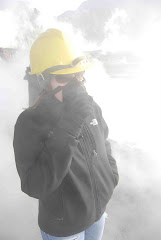
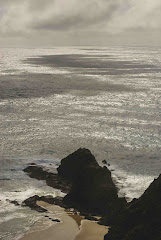
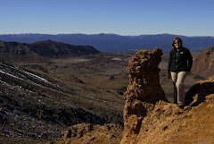
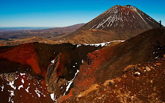
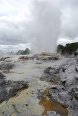
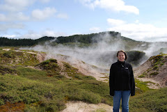
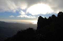
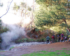
From the top of the staircase, though, we were able to forget the crazy lady. We had an excellent view of Mt. Ngauruhoe. It was an archetypal figure; looming above us, steep-sided, and richly red-colored. A small fumerole let off steam near the top. All in all, a very forbidding image. (So forbidding in fact, that it was used as Mount Doom in the Lord of the Rings movies.)
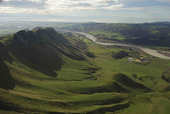
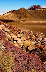
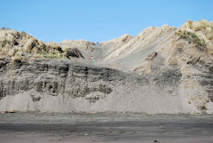
If Ngauruhoe offers the perfect mental image of a volcano, Tongariro is its opposite. It is the lowest of the three volcanoes in the range, and sprawls out across the northern end of the national park, with several old craters flanking the main crater. We walked over the barren surface of Tongariro’s Southern Crater and climbed up its sides.
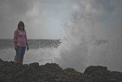
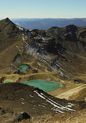
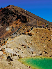
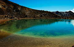
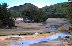
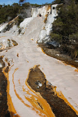
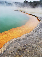
We then climbed a little further, scrambling up a rocky surface before choosing instead to walk in the snow, before reaching the Red Crater. Aptly named, the stunning colors result from the ferrous oxide expelled by the volcano. In the side of this crater, you could see a deep gash that seemed to tunnel deep into the volcano. From here, you could also look down on the several amazingly blue-green lakes, known at the Emerald Lakes. The color combinations were dramatic, and we decided to have lunch near the lakes. Up on the ridge, near the top of the Red Crater, it was very cold, with little protection from the wind. So we started our steep climb down, each step sliding several feet through loose rocks. After a few steps, you adjusted your movements so that you could use the slide to further your progress. It was very fun, sliding down with each step.
After lunch, we continued on our walk, passing through the Central Crater of Tongariro. It wasn’t until we had crossed it and climbed back out that we noticed the old lava flow. In the center of this large crater, you could see the black, cold lava that must have flowed from the current crater at some point. It was amazing.
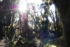
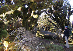
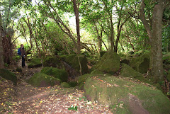
The remainder of the walk slowly led you back down through the alpine tundra to the tree line. It was pleasant and easy-going. You could see why the walk was supposed to be the “best day walk” in NZ; our only grumble was that too many other people must have heard that claim, too. But you can’t always have it all, so we won’t complain!
Tuesday, April 14, 2009
Subscribe to:
Posts (Atom)